


Round Springs Township Voting District, Mitchell County, Kansas
About
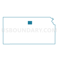
Outline

Summary
| Unique Area Identifier | 585974 |
| Name | Round Springs Township Voting District |
| County | Mitchell County |
| State | Kansas |
| Area (square miles) | 35.87 |
| Land Area (square miles) | 35.86 |
| Water Area (square miles) | 0.01 |
| % of Land Area | 99.98 |
| % of Water Area | 0.02 |
| Latitude of the Internal Point | 39.26864640 |
| Longtitude of the Internal Point | -98.21716810 |
Maps


Graphs
Select a template below for downloading or customizing gragh for Round Springs Township Voting District, Mitchell County, Kansas


Neighbors
Neighoring Voting District (by Name) Neighboring Voting District on the Map
- Battle Creek Township Voting District, Lincoln County, KS
- Bloomfield Township Voting District, Mitchell County, KS
- Blue Hill Township Voting District, Mitchell County, KS
- Center Township Voting District, Mitchell County, KS
- Hayes Township Voting District, Mitchell County, KS
- Orange Township Voting District, Lincoln County, KS
- Salt Creek Township Voting District, Mitchell County, KS
- Scott Township Voting District, Lincoln County, KS
Top 10 Neighboring County Subdivision (by Population) Neighboring County Subdivision on the Map
- Scott township, Lincoln County, KS (104)
- Bloomfield township, Mitchell County, KS (76)
- Orange township, Lincoln County, KS (68)
- Center township, Mitchell County, KS (39)
- Battle Creek township, Lincoln County, KS (35)
- Salt Creek township, Mitchell County, KS (33)
- Blue Hill township, Mitchell County, KS (27)
- Round Springs township, Mitchell County, KS (24)
- Hayes township, Mitchell County, KS (16)
Top 10 Neighboring Unified School District (by Population) Neighboring Unified School District on the Map
- Beloit Unified School District 273, KS (5,061)
- Waconda Unified School District 272, KS (2,651)
- Lincoln Unified School District 298, KS (2,463)
- Sylvan Grove Unified School District 299, KS (856)
Top 10 Neighboring State Legislative District Lower Chamber (by Population) Neighboring State Legislative District Lower Chamber on the Map
Top 10 Neighboring State Legislative District Upper Chamber (by Population) Neighboring State Legislative District Upper Chamber on the Map
Top 10 Neighboring 111th Congressional District (by Population) Neighboring 111th Congressional District on the Map
Top 10 Neighboring Census Tract (by Population) Neighboring Census Tract on the Map
- Census Tract 1766, Mitchell County, KS (4,486)
- Census Tract 861, Lincoln County, KS (3,241)
- Census Tract 1767, Mitchell County, KS (1,887)